Awana Digital
Indigenous People safeguard 40% of the Earth's intact land yet their land rights often remain unrecognized and they’re increasingly under threat.
The Idea
Community-created Maps to Defend Land
Fellow

Emily Jacobi
Mulago Lead
s


Total Investment
600000
Grants
0
Equity/SAFE
0
Debt/Convertible Debt
Funded Since
2023
Geography
Sector
Structure
The Mission
Protect critical ecosystems
How It Works
Awana helps communities maintain guardianship and defend their land against threats. They developed a user-friendly, participatory mapping software called CoMapeo. Communities decide what to document and use CoMapeo to define, defend, and govern their territories.
The Dream
Indigenous and marginalized communities all over the world use Awana Digital tools (free of charge as a public good) with minimal external support from local NGOs to map and protect their territories.
Why We're In
Indigenous People need tools to fight for and safeguard their land rights long-term and Awana’s software was built with and for communities. The technology has grown organically to 13K users who have mapped and monitored 17M hectares worldwide. Indigenous communities using Awana’s mapping software have had six precedent-setting legal victories, with seven more active. These landmark rulings have outsized influence on land tenure for indigenous and local people globally. We’re betting that CoMapeo provides value to the indigenous guardianship movement.
Delivery
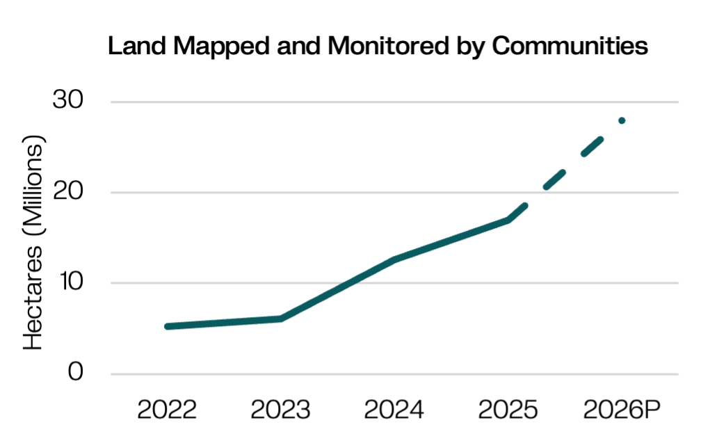
Indigenous communities around the world are increasingly using Awana’s tools to map and monitor land. The total hectares mapped and monitored is projected to reach 28M by the end of 2026.
The Model
A solution that works and can scale.
Design the Map
Communities collectively decide what’s at stake and what categories of things they need to document: ancestral sites, biodiversity, natural resources, threats, etc.
Make the Map
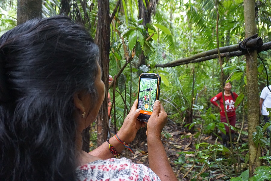
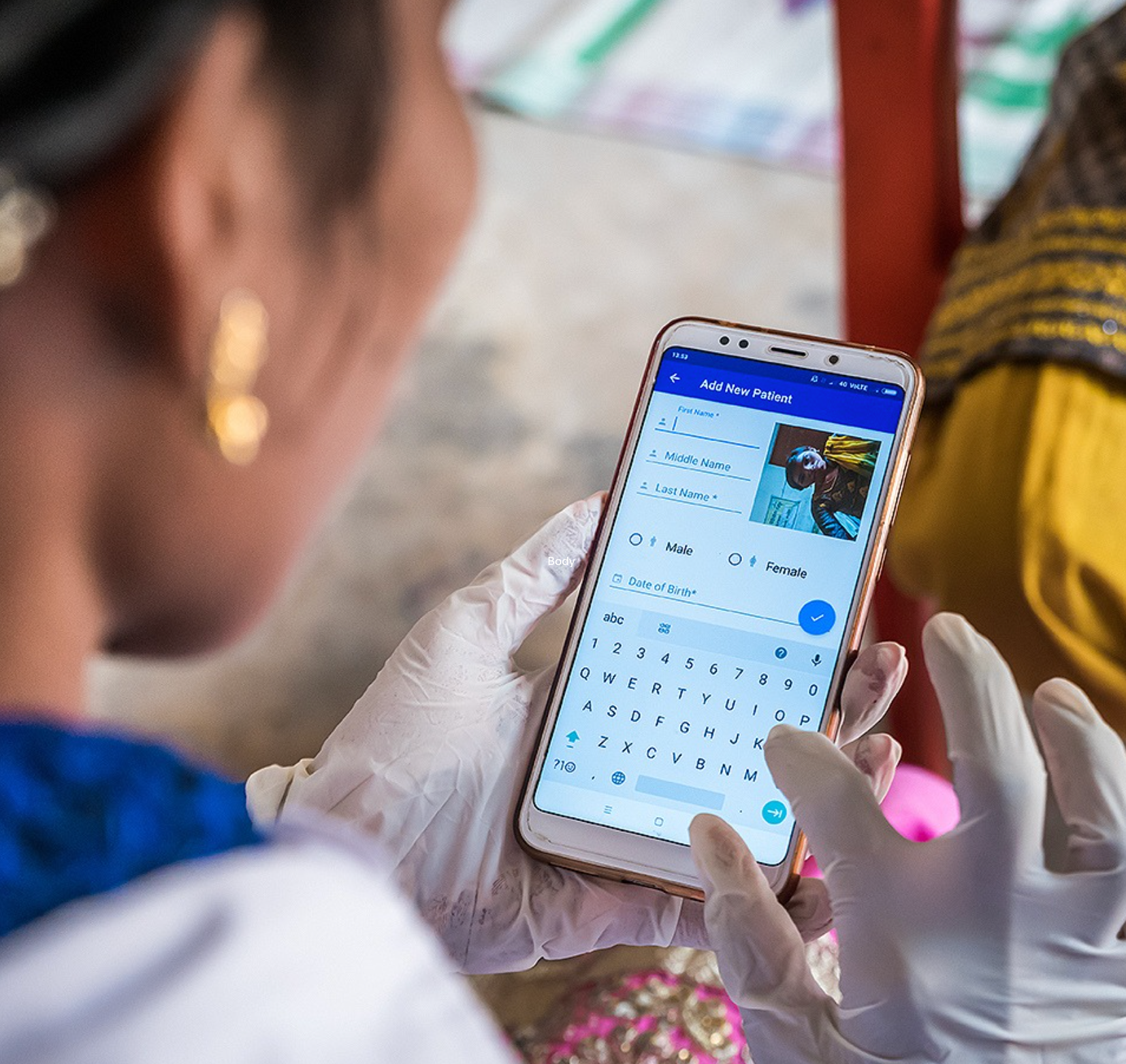
Communities are trained on how to use the software (CoMapeo) then walk the territory and use smartphones to map critical resources and landmarks, and/or monitor threats and resources
Validate the Map
Communities collaboratively edit the map to verify and validate information leveraging collective knowledge about the territory and satellite data
Use the Map
Communities use the map to gain tenure, defend their land rights (via legal disputes) and/or hold offenders accountable, such as reporting illegal activity to authorities
Expand its Use
By going through this process, communities strengthen their own governance and land management and continue to use the tool to map more things to achieve new victories and advance their effective management of critical ecosystems
Potential for Impact at Scale
Mulago uses four criteria to gauge potential for exponential impact. The model must be:
This is about impact and evidence. Indigenous communities have mapped and monitored 17 million hectares using Awana’s software. The resulting data and maps have contributed to six landmark legal victories, with seven additional cases pending. Because the tool is a public good used globally, it’s hard to measure its overall impact. Still, a strong set of case studies—and credible counterfactuals—suggest that when used well, the tool can transform internal governance and strengthen communities’ ability to navigate complex legal systems, secure lasting rights, and defend their territories.
This is about scope. Communities often begin using CoMapeo when facing a credible threat or other catalytic pressure—but when that moment comes, interest is high. Even in places with limited technical expertise and little to no connectivity, CoMapeo works offline and is designed to be simple and intuitive. Mapping requires only a few smartphones, which most communities can access directly or through NGO partners. A strong network of trusted local NGOs exists and can train and support communities through the process.
This is about whether NGOs can deliver the model. Awana has developed a best-in-class tool designed specifically for low-tech settings and a systematic approach to working with communities to create and use maps for legal wins. They have replicated their success across numerous geographies and communities and have worked with local NGOs who are replicating Awana’s model in their own contexts. They spent the last two years upgrading the back-end of their software to ensure the tech has capacity to support widespread usage across communities and contexts. They are working on developing clear guidance and digital support functions for users.
This is about what the model costs when Indigenous communities use the tool with NGO support. Costs fall into two categories: maintaining core technology and conducting mapping and monitoring work. Right now, Awana is making a big investment to ensure their tech is best in class. Once that is complete, their ongoing tech costs will be ~$350K/year, funded by philanthropy. Mapping & monitoring work has two parts that NGOs pay for via philanthropy: initial project set-up and ongoing implementation. The initial training workshop costs $500-10K and setup costs (for devices, customization of categories, and background maps) are $2K-$10K. Project implementation ranges between $10K–40K/year (for additional workshops, mapping trips, and staff). Over time, as CoMapeo becomes more self-service, communities may rely less on NGOs, significantly lowering costs. Awana aims to refine cost estimates this year.
.png)
Awana is in Growth stage, equipped with their newly upgraded core mapping software - CoMapeo - they are now testing approaches to grow the technology’s use across key landscapes across Brazil, Indonesia, the Solomon Islands, and the Congo Basin.
Our Take
CoMapeo is one piece of the broader fight for sovereignty, so attribution will always be difficult. Because the tool is free and publicly available, we may never fully know its global impact. Still, Indigenous communities are using it to real effect. As Awana strengthens its measurement approach, we expect a clearer picture over time. CoMapeo has been intentionally designed to be accessible, and the team has made major strides in simplifying it and systematizing how maps are developed and used. NGOs are already beginning to take on the tool and train community partners. We don’t know much about what this will end up costing local NGOs to partner with communities, which could be a barrier if costs end up being much higher than expected.
Are you a serious funder and want to learn more?
This is just a snapshot of what we know about the organization. If you're an investor or funder that might send some serious dough their way, we're always delighted to share more. Reach out and we'll connect you with the right person on our team.
*this is not monitored for funding requests.
.jpeg)